What is the oldest neighbourhood in Toronto?
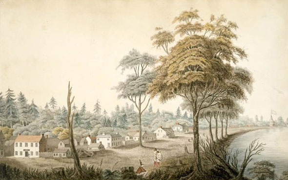
In 1793, the little frontier town of York consisted of just 10 blocks: two rows of five stacked on top of each other between present day George, Front, Adelaide, and Berkeley streets. The entire city of Toronto grew from this tiny waterfront nucleus.
The original city is now firmly within the St. Lawrence neighbourhood. King St. east of Jarvis cuts right through the centre of the more than 200-year-old community.

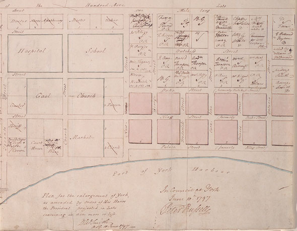
In 1797, plans were made to extend the city to the north and west. Peter Russell, an administrator who succeeded town founder John Graves Simcoe, mapped out new roads west to Peter St. and north to Queen St. The extension included space for a market, court house, church and jail.
As historian Wendy Smith notes, the westward push was limited by an "ordnance boundary" located 1,000 feet east of Fort York. The canons that were meant to protect York from invasion needed a clear line of sight and so, at the time, nothing could be built closer to the military base.
Smith's website, the Toronto Park Lot Project, maps the early boundaries of Toronto.

The allowance for a market spawned today's St. Lawrence Market (the original allocation is currently occupied by St. Lawrence Hall) and the church block is now home to St. James Cathedral. The city's first coffee shop was also located in the area, as was the first Upper Canada parliament buildings at Front and Berkeley.
The jail was built, too. It opened in 1798 with a small outdoor area for public executions. According to a plaque fixed to the outside of the King Edward Hotel, which now occupies the site, the first person hanged there was John Sullivan. He was convicted of stealing a forged bank note worth a dollar.
As the city grew, the original town blocks became part of the St. Lawrence Ward. The earliest community divisions were mostly named for the patron saints of the countries of the British Isles: St. George, St. Andrew, St. Patrick, and St. David.
St. Lawrence of Rome became associated with Canada when French explorer Jaques Cartier named the continent's great eastern waterway after him in 1535.
The oldest buildings in the St. Lawrence neighbourhood date back to the 1820s, 1830s, and 1840s. On Front St., many of the historic former warehouses and factories turned storefronts were built in the 1870s and later, more than eight decades after the neighbourhood was established.
Chris Bateman is a staff writer at blogTO. Follow him on Twitter at @chrisbateman.
Images: Toronto Archives, Peter Russell map, Toronto Public Library, Ms1889.1.3.; Elizabeth Frances Hale watercolour, Library and Archives Canada, 1970-188-2092
Latest Videos
Latest Videos
Join the conversation Load comments


