
Cheltenham Badlands and Forks of the Credit
When I was brainstorming ideas for what to do last weekend, a friend suggested we visit the Badlands. Badlands? As in those odd, Mars-like barren dunes you find out west? I told her that sounded swell and all, but this was going to be a one day adventure and a trip to Alberta was out of the question.
No, the Cheltenham Badlands, she said. In Caledon.
Oh. There are badlands in Caledon?
Another friend then piped in and suggested that if we headed that way, we should visit the waterfalls as well.
There are waterfalls in Caledon?
Okay, to anyone from the Caledon region, I apologize and profess my ignorance. Up until now, I only knew of your town as that place north of Brampton, a place I occasionally drove past when I was visiting my relatives in the suburbs. But yes, after spending a sunny afternoon in your home, I admit that a lovely land of rivers and waterfalls and alien hills lies just an hour north on Hwy 10.
First stop: a visit to the Badlands.
The Badlands come up on you quickly. Real quick. Off of Hwy 10, you turn onto Old Baseline Road, and from there, it's up and over a few hills before you are literally on top of them. There's a small parking lot off to the side of the road, then a small embankment, and then, you're there.
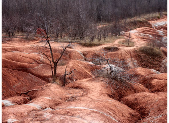
And I must say, they're pretty impressive - all red, rolling hills with streaks of greyish-green, and a few jagged trees for that creepily beautiful look. The whole scene is a bit hypnotizing.
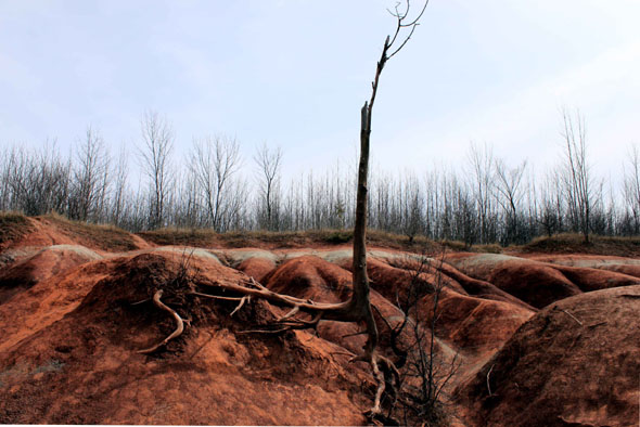
The term "badlands" refers to land that is highly eroded, barren, and dry. The Cheltenham Badlands are the result of a delicate, soft rock called queenston shale. Because the rock is so sensitive, it erodes easily, creating those rolling, red dunes that look like another planet. Badlands are rare in Ontario because in most spots, rocks, sand, and gravel cover and protect any shale, but Cheltenham is considered to be one of the best samples of badlands topography in the province.
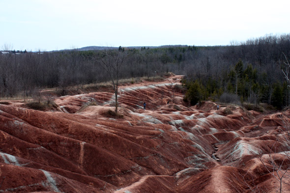
They started forming back in the early 1900s, when the land was cleared for farming. The combination of removed vegetation and grazing livestock exposed the shale, and, even though it's no longer used as farmland, Mother Nature has been eroding it ever since.
But, as we reported a few years ago, the Badlands are in danger of their own popularity. When I was there, a handful of people and some rambunctious children were scrambling all over the hills, which as I previously mentioned, are extremely delicate. (Not only that, but there were broken beer bottles scattered in the dirt.) Anyway, the problem (besides the beer) isn't lack of signage, as there's a sign right next to the site, asking people to respect the trails, to stay off the hills, etc.; the problem is that the signage isn't obvious.
I know that large signs would litter up the place, and I definitely don't want a viewing platform installed or a fence marking off where you can stand, but the warning sign is easy to miss. I admit that I walked right past it, and, in my own ignorance, I ventured down onto the hills. It wasn't until I looked down and saw the cracks in the ground beneath me that I thought "hey, maybe I shouldn't be walking here," and then I noticed the sign as I was leaving. Note to hikers: the Bruce Trail passes by the Badlands, but unfortunately, this section of the trail is currently closed for environmental regeneration.
Second stop: Forks of the Credit.
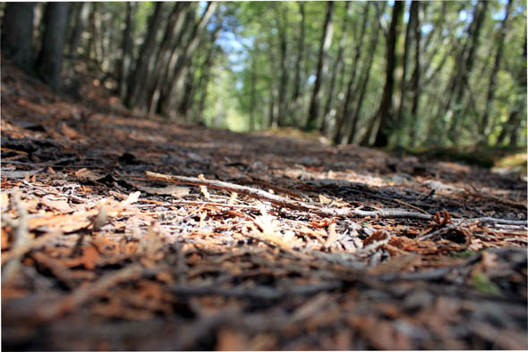
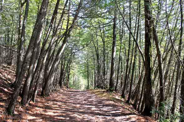
Back in our car, we returned towards Hwy 10 and ventured further north, to Forks of the Credit Road. From there, it's an up-and-down and twisty ride, with the Credit River babbling alongside you. We parked at the railway overpass and followed the nearby Tramble Trail up onto the Niagara Escarpment. The trail starts out steep, but then tapers off, and from there is a lovely shaded walk, past rock cliffs and steep drops, with the rush of the river far below. The entire area is remarkably pretty, and feels completely remote; as we wandered the trails, it was easy to forget that we were only a short drive away from Brampton and Mississauga.
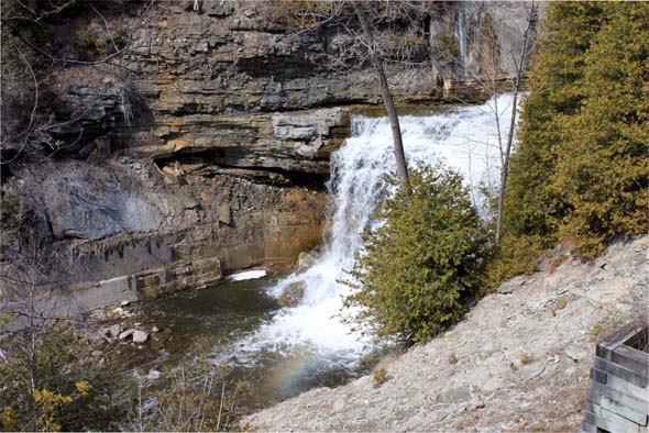
After wandering on the trail, we headed back towards our car and drove further along the Forks of the Credit (more twists and turns, and an uber steep ascent up the Escarpment), towards the tiny village of Belfountain. The town was adorable, but I had yet to see the elusive waterfalls my friend had told me about, and, much to chagrin of my boyfriend, I was getting frustrated and irritable. We spent some time traveling back and forth through town, then back and forth again, looking for a trail marker or some sign from the heavens to guide us. Finally, a local shopkeeper pointed us in the right direction: head north on Mississauga Road, towards Forks of the Credit Provincial Park.
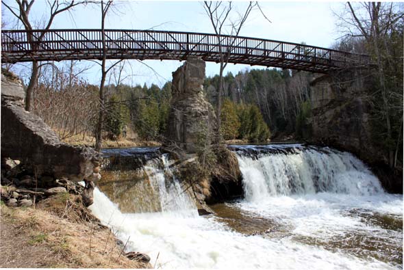
We followed her lead and ended up at the Elora-Cataract Trailway - part of the TransCanada Trail. From there, it's a 20-minute, hot, shade-less walk to the Cataract Falls and the ruins of an old hydro-generating station dating back to 1899. While the falls are pretty and the ruins are cool, they're a bit anti-climactic. The viewing platform doesn't offer the best view, and because of erosion, it's impossible to get any closer to the falls. But really, with how pretty our day tour had been, I couldn't complain.
Tired and feeling a bit sun-stroked, we headed back to our car and ventured home. Dear Caledon: I apologize for ignoring you all these years.
Writing by Tammy Burns. Photos by Stefan Wege.
Latest Videos
Latest Videos
Join the conversation Load comments


